 Inglés UdeA - Cabezote - WCV(JSR 286)
Acciones
Inglés UdeA - EnlaceInteres - JSR(286)
Acciones


Signpost
Acciones
Generales
Climate Variations: El Niño
Acciones
Climate Variations: El Niño
By: Alejandro Martínez - Professor of the Environmental School UdeA
Between 2023 and 2024, we would have an El Niño event. This is a natural phenomenon of climate variability, in which large energy exchanges between the ocean and the atmosphere occur. The combination of El Niño and climate change may increase the global average temperature and decrease rainfall in some parts of Colombia.
 El Niño is a phenomenon of global scale, characterized by an increase in sea temperature in the central tropical Pacific and changes in winds in the tropical belt.
It can start in several ways. One possibility is that the surface waters of the central tropical Pacific begin to warm more than usual, which may weaken the winds over the ocean that normally blow westward in that region. This wind reduction may, in turn, cause the "blob" of warm Pacific waters to move even further to the center and east. This manifestation portrays a feedback between the ocean and the atmosphere. A change in the ocean - warmer waters over the central Pacific - can modify the winds, which turn weaker to the west. This, in turn, can reinforce the initial change over the ocean: more warm waters to the central and eastern Pacific.
When the central tropical Pacific is warmer than usual, and there is an interaction with an atmosphere with weaker westerly winds, some conditions necessary for an El Niño may be present. A combination of more or less opposite conditions over the tropical Pacific has also occurred in other years, and it can be associated with La Niña. In reality, both are part of the opposite - though not wholly symmetrical - extremes of a very important oscillation in the states of the atmosphere and the ocean called El Niño/Southern Oscillation or ENSO for short.
In summary, El Niño and La Niña are phenomena in which oceanic and atmospheric variations are coupled. They generally produce changes in winds and cloud distribution, which affect rainfall patterns over large regions of the world, including the tropics. For example, in the case of Colombia and northern South America, the rising air that helps form clouds and rainfall weakens during El Niño. In contrast, other regions may experience increased precipitation, as in parts of Argentina and the southern United States.
There are years when El Niño conditions dominate and other years when we have La Niña. We can also have neutral years, such as when there are changes in oceanic but not atmospheric conditions, or vice versa, or when neither oceanic nor atmospheric patterns resemble El Niño or La Niña. Moreover, not all El Niño events are the same. Some start earlier in the year -e.g., June- and others later -e.g., October-; some may last a few months -e.g., nine- and others longer -e.g., 14-; some may be weaker -e.g., years 2009-2010- and others stronger -e.g., 2015-2016. Furthermore, neither El Niño nor La Niña are strictly periodic phenomena: They do not happen yearly or repeat exactly every few years. Rather, what happens is that between one El Niño and another, between three and seven years or so may pass.
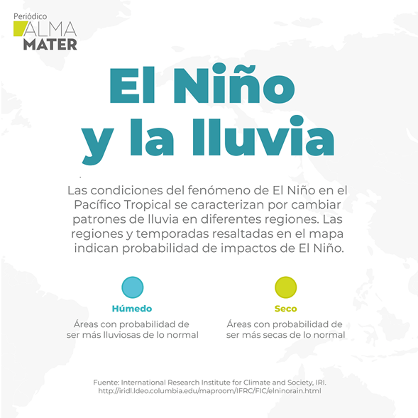
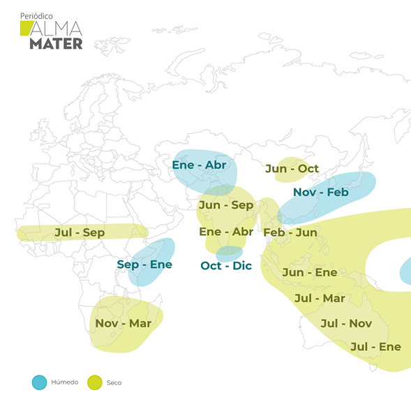
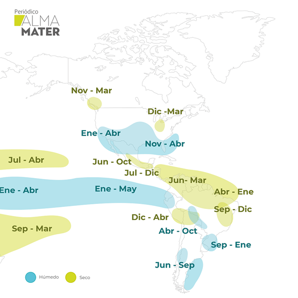
The map shows typical El Niño effects on rainfall in different parts of the world and months. For example, El Niño is associated with less rain over Colombia, especially between December and March. Other regions may have more rainfall than usual and in different months. This pattern does not occur the same way in all El Niño events. Source: International Research Institute for Climate and Society (IRI).
During El Niño, energy is delivered from the tropical Pacific Ocean to the atmosphere above it. The atmosphere then exports some of this energy - changes in wind patterns and cloudiness - to other regions. In general, during El Niño, an increase in the atmosphere's energy, much of which comes from the ocean, can be experienced. It can be partially evidenced by the rise in the global average near-surface air temperature. For this reason, the combination of climate change - which tends to increase the planet's average surface temperature - and El Niño may lead to a global average of several warmer months than usual.
Some effects in Colombia
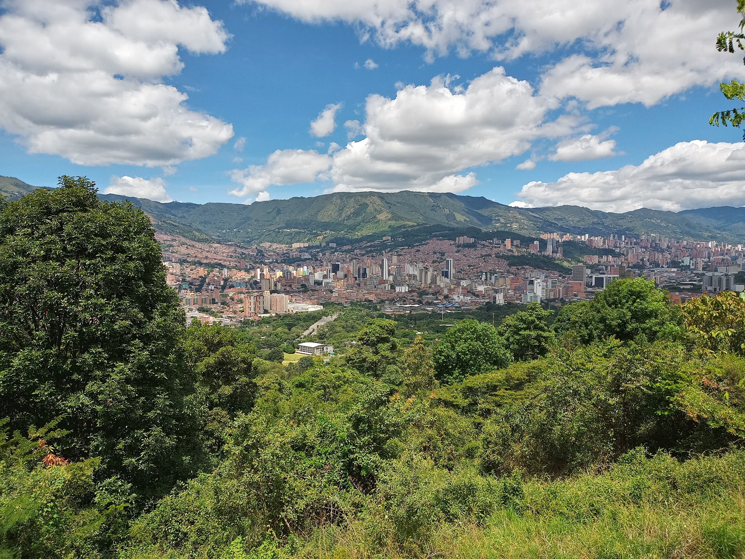
In the case of Colombia -especially in central and northern Colombia- El Niño is often associated with less rainfall and higher temperatures than usual. La Niña is often associated with the opposite: more rain than usual, as between 2010 and 2012, or recently between 2020 and early 2023. The reduction in rainfall associated with the 1991-1992 El Niño was one of the factors in the energy rationing and la "Gaviria hour" time change enacted in Colombia in 1992. Later, the 1997-1998 El Niño was one of the most intense, with severe impacts globally, including arid conditions over Colombia and several damaging effects on sectors of the economy. The 2015-2016 El Niño was also very intense - some even named it "El Niño Godzilla" - and had the country on the brink of energy rationing. In fact, the combination of El Niño plus the increase in global temperature associated with climate change made 2015-2016 one of the warmest periods in recent history.
In June 2023, we are already experiencing El Niño conditions, which are classified as "weak" for now. Forecasts made with different numerical models on how the central Pacific and the coupled ocean-atmosphere system will evolve suggest that there is more than a 90% probability that El Niño will persist until the beginning of next year and will be stronger during the second half of 2023. We could have a moderate to strong El Niño from December through April. This is particularly important because El Niño impacts are usually more pronounced between December and April. If these forecasts come true, a significant part of Colombia could experience reduced rainfall between the end of this year and the beginning of 2024, along with higher-than-usual temperatures. This combination is worth paying attention to, as it could lead to drought, reduced river and reservoir levels, etc.
Featured
At the global level, the World Meteorological Organization (WMO) has also made a call to prepare for this El Niño because of the effects it usually has on different regions and its combined effect with climate change that produces higher temperatures than usual. In particular, in a report published in May, the WMO warns that there is a 98% probability that the average temperature over the next five years will be 1.5°C above pre-industrial levels: What we usually had more than a hundred years ago when humans did not affect the climate system as much. This increase in temperature may not seem like much. Still, when considering the entire planet, it means a huge change in the energy of the climate system, which can increase the likelihood of extreme events such as severe storms and droughts. In fact, there is also a 98% probability that one of the next five years will be the warmest in recent history.
Scientific research, including that of local universities, has taught us a lot about the characteristics, evolution, prediction and impacts of El Niño and La Niña on our country. Meteorological and climate services such as Ideam and Siata permanently monitor and update the forecasts associated with ENSO. Although the effects of El Niño are typically stronger between December and April, we can also feel some of them between July and October. To be better prepared for El Niño, citizens must take advantage of the knowledge, recommendations and warnings issued by climate services, universities and risk management departments.
Portal U de A - Redes Sociales - WCV(JSR 286)
Acciones
Inglés UdeA - Iconos Footer - WCV(JSR 286)
Acciones